The Lavant Stream
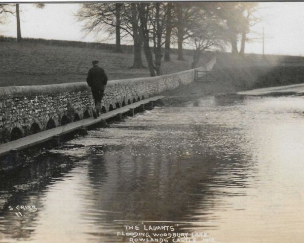
The Lavants flooding, postcard by Cribb
The Lavant Stream is a distinctive and historically significant watercourse that flows through Rowlands Castle and the surrounding Hampshire countryside.
The word Lavant carries a dual meaning. It is both the name of a specific watercourse and a geological phenomenon that has shaped our local landscape and culture for centuries.
What is a Lavant?
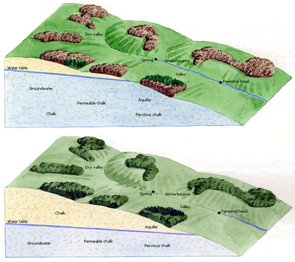
Technically termed as a winterbourne, Lavant is the term used in Hampshire and West Sussex for the phenomenon that occurs in chalk landscapes after periods of heavy rainfall during winter months forming a shallow, intermittent stream.
In Wiltshire and Dorset the same phenomena is known as winterbournes and winterbornes, in Kent is known as nailbournes, and known as a gypsey in York.
© The Chiltern Chalk
Streams Project
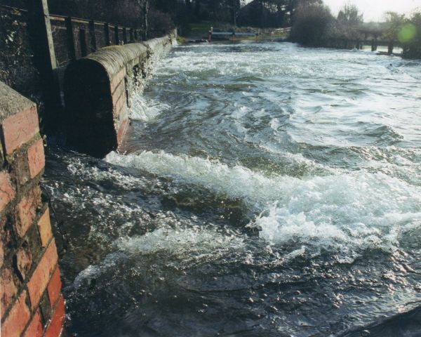
The Lavant Stream in Rowlands Castle is fed by the chalk aquifers of the South Downs. Depending on the amount of rainfall, “the Lavant,” as it is referred to locally, is usually dry in summer and autumn months. In winter and spring months when the water table rises following sustained periods of heavy rainfall, water bursts forth from the chalk aquifers at various spring points creating the Lavant Stream. When the water table drops during drier months, the Lavant disappears, leaving behind grassy dells.
The first recording of the term “Lavant” is in 1774 by Gilbert White in his letters to a judge, the Honourable Daines Barrington.
“The land-springs, which we call Lavants, break out much on the downs of Sussex, Hampshire and Wiltshire. The country people say when the Lavants rise, corn will always be dear.”
Barrington had established a format for keeping daily observations on weather, which was the subject of their correspondence. White meticulously recorded the weather in nearby Selborne for over 25 years in his daily journals which were crucial to his pioneering ecological studies in his book, The Natural History and Antiquities of Selborne.
The Path of the Lavant Stream
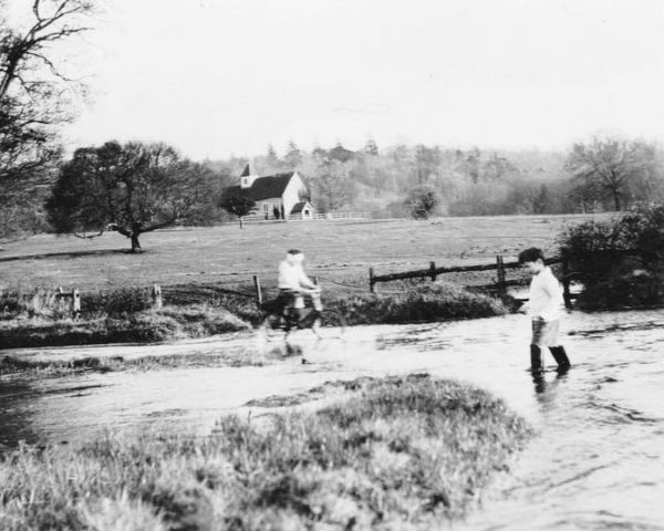
Idsworth flooding, c. 1950
John Bush
- In Rowlands Castle, the Lavant Stream, distinct from the River Lavant in Chichester, is a classic winterbourne fed by two primary sources: chalk aquifer recharge and surface run-off. The primary source is the underground chalk aquifers of the South Downs.
- In almost all winters, the stream receives run-off from the nearby impervious Tertiary clays and Reading Beds. These clay-rich soils do not absorb water, causing it to flow over the surface into the low lying valley. The combination of the soils, geology and landscape in the local area is how we have the geological phenomenon of the Lavant Stream.
Key Locations and Direction of Inflow
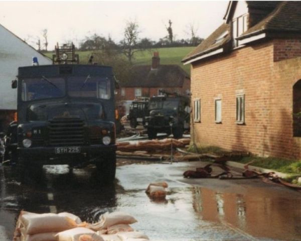
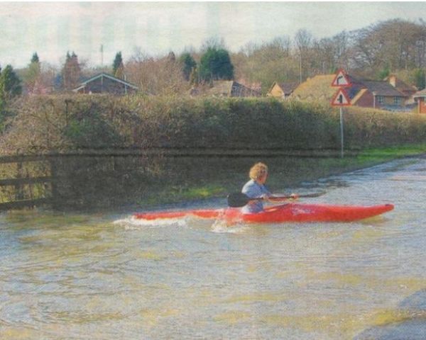
Finchdean flooding, 1994
Green Goddesses assist
the Fire Brigade. Ted Redsull
- Idsworth & Finchdean: The stream typically begins in the hamlet of Idsworth near St Hubert’s Church as the groundwater level rises in the “Idsworth Lavant” where it flows south running alongside Finchdean Road and past the village of Finchdean
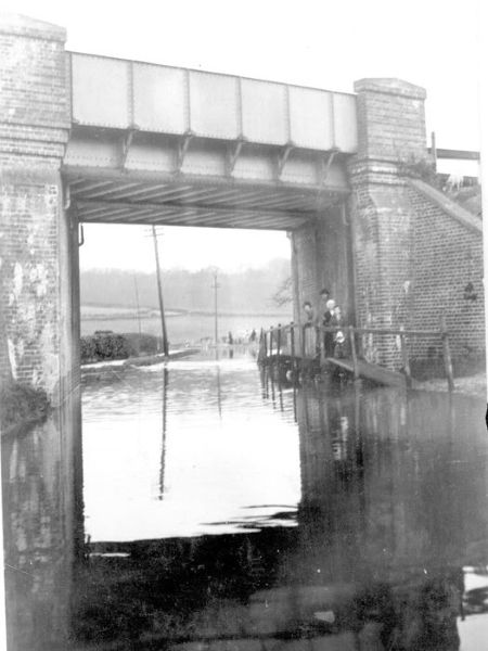
- Rowlands Castle: In the village the stream crosses Woodberry Lane at the ford, flowing south running alongside the South Western Railway line, crossing under the train line just above the intersection of Whichers Gate Road. During periods of heavy rainfall, the high groundwater and surface run-off cause the Lavant to rise high enough at the ford to cause flooding in the village and Woodberry Lane to be closed, often for several months.
- Havant Thicket: The stream drains this area from the drainage pathways in Havant Thicket and Southleigh Forest as it moves south towards Havant.
- Havant: The Lavant Stream joins the Lavant (Hants) WFD River.
The flow is highly seasonal; in summer, the water table often drops below the stream bed, leaving the channel dry until the next period of significant recharge.
The Lavant Stream follows a specific geological low point through the landscape:
Woodberry Lane torrent
in 2000 before new defences. Ted Redsull
- Origin: It typically begins in the hills around Chalton, Idsworth and Finchdean.
- Rowlands Castle: It flows southwards through the east side of the village down a broad shallow valley in the landscape. It is the shallowness that contributes to the flooding in the village. You can see the dry bed (or the rushing torrent!) running alongside Finchdean Road and at the ford in Woodberry Lane.
- Destination: The stream continues south from the village towards Havant joining the Lavant (Hants) WFD River that discharges into Langstone Channel.
Importance to the Area
The Lavant Stream has been central to the history of Rowlands Castle for millennia:
- Roman Industry: The presence of this water source aided the Romans in establishing a massive pottery industry in the area. The water was essential for processing clay.
- Biodiversity: Chalk streams are globally rare habitats and the Lavant Stream is considered a winterbourne chalk stream. When the Lavant flows, it supports specific flora and fauna adapted to this “on-off” cycle of water, providing a unique ecological niche.
- Village Identity: The stream defines the geography of the village. “The Lavant” is a point of local conversation, marking the change of seasons and the health of the local environment.
The Power of the Flood
While the Lavant Stream is a natural wonder, it presents significant challenges for residents:
- Unpredictability: Because the flow is dictated by the water table rather than immediate rainfall, the stream can suddenly “appear” even on a sunny day if it rained heavily weeks prior in Chalton, Idsworth and Finchdean.
- Infrastructure Stress: The intermittent nature of the stream means that culverts and drains can become blocked with debris. When roads become flooded for long periods it causes the pavement to break up causing potholes and the edges of roads to crumble.
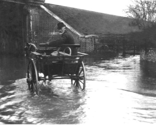
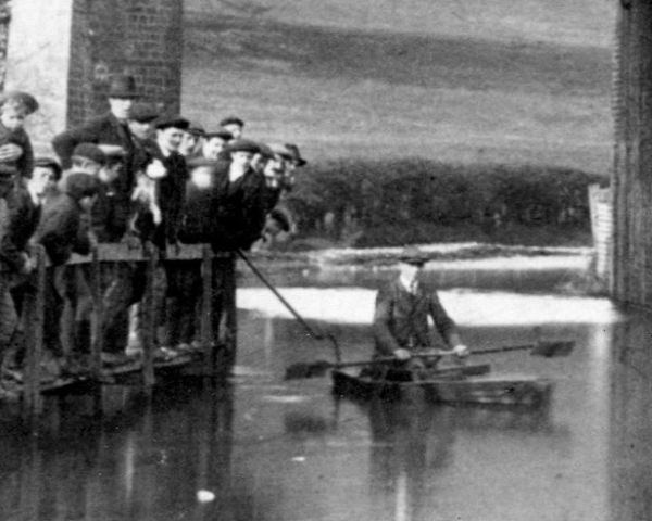
- Property Damage: Historically, the Lavant has caused severe flooding. Notable events, such as those in 1994, 2000, and 2014, saw the stream burst its banks, flooding homes, roads and fields, such as Maize Copse, and making Woodberry Lane, Finchdean Road and parts of the village impassable.
- Flood Depth: The year 2000 saw the heaviest rainfall in Havant since Portsmouth Water Company records began in 1886, with 1175mm falling in the full year. As part of the improvement works carried out subsequently, a depth gauge was located at the ford on Woodberry Lane in the village. Residents keep a close eye on this gauge every winter, as it serves as an early warning system for the entire community.
1900 DeanLane End
Paul Marshman
1911 Dean Lane End Harry Price In His Punt
Paul Marshman
1950 Dean Lane End
John Bush
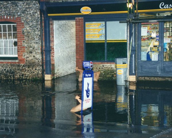
2001 Flooding Castle Stores (now Londis)
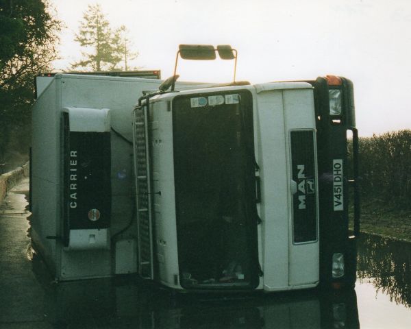
2003 Lavants Lorry Overturned
Ted Redsull
2007 Woodberry Lane
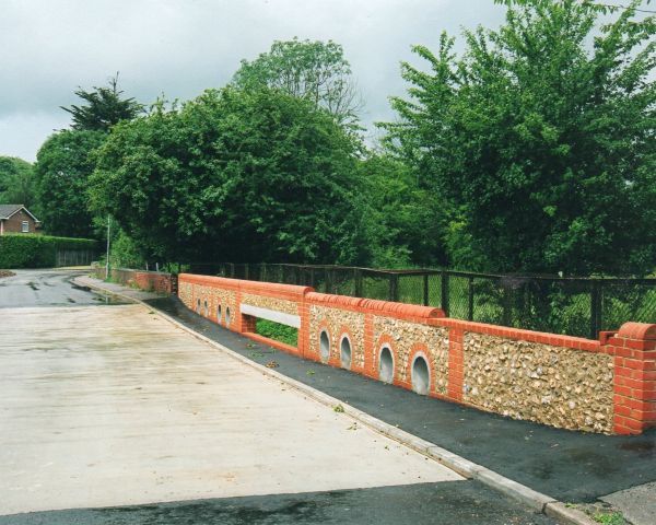
2003 Lavant’s New Ford Completed
References and further reading
The Lavant Stream at Havant, Rowlands Castle and Finchdean, WEST, R., MARSHMAN, P., & LEE, A. 2017. Park Design & Print.
Chalk Streams | Sussex Wildlife Trust [2026]
Winterbourne (stream) – Wikipedia [2026]
Water Body – Lavant (Hants) Flood Mapper 2023-2025.
Flood Alert Info – Groundwater flooding in Finchdean, Dean Lane End and Rowlands Castle FloodAssist. 2017-2026.
How do chalk streams work? Chilterns Chalk Stream Project. 2011-2026.
The Natural History and Antiquities of Selborne, WHITE, G. 1789. London, B. White and Son.
OED Oxford English Dictionary [2026]
Rebecca Jessup, March 2026